Waikaremoana Loop
Login or Join Adventure Guide for full access to the Adventure Map, plus information including detailed route notes, fuel stops, food supplies/dining, accommodation, preparation and safety, downloadable GPX files plus a printable booklet.
Route Overview
General Overview
This Adventure was created and personally logged by Ross Bowden. Ross is a keen adventure rider with an extensive knowledge of the remote North Island track network.
The Waikaremoana Loop Adventure is a great one day loop that includes both tarmac, and public access gravel roads.
It makes its way through Whirinaki Forest, Lake Waikaremoana, and various rolling hill farmland with as many interesting gravel roads as possible. It also passes though Boundary Stream National Reserve.
This loop includes noteworthy roads such as Waipunga Road, Waikaremoana Road, Waihi Road, Pohokura Road, Waitara Road, and SH5.
This Adventure is suitable to adventure bikes of all types, and 4X4 vehicles.
Start/Finish Point
While this Adventure can be started from a number of entry points along the route, a natural starting point is the intersection of Pohokura Road and SH5. This is where Leg 1 starts from, and where Leg 2 ends.
Terrain includes
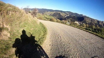
This Adventure aims to have as many interesting gravel roads as possible, and while there are still a reasonable number of tarmac stretches, the volume of gravel roads will please any back-road gravel seeker!
All the gravel roads included in this Adventure are Grade 1 and Grade 2.
There are a number of small streams to ford but nothing that poses any challenge when the streams are running at normal flow rates. Most will be running around 6 inches deep.
Distance
331 km
Max Fuel Leg
193 km
Travel Time
This is a full day Adventure. The actual time taken will depend on how long you spend at some of the natural stopping points such as the lookouts, lakes, rivers etc.
The average travel time for the entire route is 6.5 hours.
It is recommended to start this route early in the morning so that you are not rushing later in the day.
Accommodation
While this is intended as a day adventure, there is a campsite as an option for camping at Waikaremoana. This is detailed in the Leg 1 route notes.
Access Permission
No permission is needed to access the roads in this Adventure, however please note that some of the gravel roads pass through public access easement property. While it is legal to pass through these areas it is important to stick to the road.
Access Limitations
This Adventure is recommended for fine weather. If there has been recent heavy rain then the fords can become deep and potentially impassable.
On Waikaremoana Road, be aware of camper vans, and vehicles towing boats.
Ideally you'll want to do this route when the visibility is good, as the views are outstanding on a clear blue sky day.
Safety
While this is not considered a technical route it does include a few semi-remote areas. For this reason it is recommended carry tools and spares for any trail side repairs, and carry an emergency beacon or satellite tracking device.


