Smoking Dragon
Login or Join Adventure Guide for full access to the Adventure Map, plus information including detailed route notes, fuel stops, food supplies/dining, accommodation, preparation and safety, downloadable GPX files plus a printable booklet.
Route Overview
General Overview
The Smoking Dragon Adventure route criss-crosses the Main Divide with a range of sidetracks and remote destinations. It delivers views of spectacular valleys, lakes, rivers, and constantly changing vistas from mountain ranges, open tussock land, to lush native bush.
This Adventure is focused on utilising tarmac, gravel roads, and 4X4 tracks to access a range of stunning New Zealand locations. Although this is not a highly technical route, it requires reasonable skills to navigate some of the Grade 3 sections.
Where did the name Smoking Dragon come from you may ask? Well, it came as a result of the route outline on the map looking like a smoking dragon's head!
Start/Finish Point
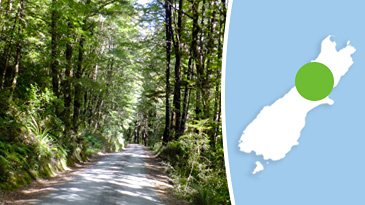
The start and finish point is Christchurch.
Terrain includes
Terrain from Tarmac through to Grade 3 will be encountered.
Most of the tarmac sections are superbly maintained, allowing you to focus on the dramatic landscapes.
As you venture onto the Grade 1 and Grade 2 gravel roads and 4X4 tracks, they will deliver enjoyable terrain mixed with rugged New Zealand scenery.
The Grade 3 tracks bump up the enjoyment factor if you like technical terrain, and have the benefit of allowing you to access the more remote areas.
Distance
1,185 km
Max Fuel Leg
246 km
Travel Time
This Adventure is made up of six legs, and can be done in two recommended options:
Option 1 (6 days) : each leg can be easily travelled in one day for a relaxed paced trip, at an average of 4 1/2 hours conservative travel time each day.
Option 2 (4 days) : if you prefer to cover lots of ground when you are out adventuring, or you have limited time, then you can combine Leg 1 and Leg 2, and also combine Leg 4 and Leg 5. This will produce an action packed 4 day adventure!
Accommodation
This route has been specifically tailored around camping in great locations with the optional use of DOC huts or hotel accommodation in some locations. It is possible to pull short or go further on some of the Legs, to make use of motel/hotel/lodge accommodation if that is your preference.
Cost for camping accommodation at the recommended campsites is approximately $15 per person, per night.
Access Permission
All routes within this package are on publicly accessible roads/tracks so access permission is not required.
Access Limitations
The routes within this package are not normally subject to access limitations that present a showstopper. At some points it is possible to experience farming operations such as stock movement which may delay progress. It is feasible to encounter roadworks which may involve a detour and in some cases you may encounter forestry operations which can also involve a detour.
The only access limitation to seriously take into consideration is weather. While this route can be ridden in winter and spring with careful planning around pockets of good weather, the ideal times are summer, autumn.
Updates
-
20/11/2017 (RMOTO)The trees that were down on Cape Terrace Road as a result of the 2016 storm are now cleared.

The trees that were down on Cape Terrace Road as a result of the 2016 storm are now cleared.