Wilberforce Explorer
Login or Join Adventure Guide for full access to the Adventure Map, plus information including detailed route notes, fuel stops, food supplies/dining, accommodation, preparation and safety, downloadable GPX files plus a printable booklet.
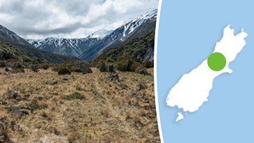
Route Overview
General Overview
This is the most comprehensive guide ever produced for exploring the Wilberforce Valley, and the surrounding valleys. It provides everything you need to explore one of the most epic High Country valleys the South Island has to offer.
Contained within this Adventure is between 3 to 5 days of exploring. It can be done as three day trip, or broken up over multiple trips.
All the important details are included for exploring each of the four separate valleys. It comes with information and locations on the four vehicle accessible huts, and also suggestions for great camping spots. This is all bundled up in a printable PDF booklet to take with you.
Start/Finish Point
This route is structured to start at Springfield, then finish in Windwhistle. The way it is structured means it can be an adventure all on its own, or, you can connect to a route you are looking to extend. The start/finish locations can be reversed if you prefer.
Terrain includes
While some of the terrain leading up to the High Country includes Tarmac, Grade 1 and Grade 2 gravel roads, the majority of this route is focused around High Country valley 4X4 tracks, and virgin riverbed on Grade 3, Grade 4 and Grade 5 terrain.
This Adventure was logged on an adventure bike over a period of months, and multiple GPS logging trips. The majority of this Adventure is accessible in a 4X4, however the tail end of some Legs that head deep into the valleys get extremely challenging, and can only be achieved on a motorbike. Full vehicle access information is detailed in each Leg.
Distance
216 km.
Max Fuel Leg
216 km.
Travel Time
Depending on how quickly you can move over the terrain, and your preference to spend time in the area, it will typically take 3 to 5 days to cover all of the routes included in this Adventure. You can do this Adventure in a series of weekends, choosing different routes each time until you complete them all. This is such an amazing place, taking your time over multiple trips and making the most of the area is a great idea.
Accommodation
This route offers a mixture of hut accommodation (4 to choose from) and camping accommodation. Carrying camping equipment is essential for this route in case the huts are already occupied.
Access Permission
All routes within this Adventure are public access and do not require permission.
Access Limitations
While each season will vary, generally the best months for this Adventure are the months of February, March, April and May. Late summer and through to early winter offer the lowest river levels, and the best chance for successful crossings.
Mid-winter to late winter often presents a low river levels however you will need to be cautious of winter rain and snowfall that can make the rivers impassable, and blanket the valley floors in snow.
Late spring and early summer will see high levels of snowmelt that can regularly raise the rivers to dangerous and impassable levels.
Safety
THIS IS NOT AN EASY ADVENTURE!
This is designed for experienced adventurers that are well-setup for challenging terrain, have a comprehensive toolkit, spares, and a good general mechanical knowledge to perform trail-side repairs if need be.
While this Adventure does pass a number of huts that can be used for accommodation, in the case they are full, you'll need a quality 3 or 4 season tent, sleeping bag, and camping gear. You'll need the ability to carry extra food in case you get caught on the wrong side of a rising river, plus an emergency beacon or satellite tracking device.
It is important to have sound understanding of the risks that come with entering the remote the High Country.
Temperatures will vary based on the season you choose to do this Adventure. Late summer temperatures will often be mild through the day, however it is possible for overnight temperatures reaching zero. In winter, overnight temperatures will often be below 0 degrees Celsius, with heavy frosts being commonplace.
Unscheduled storms and poor weather can hit the High Country in ANY season bringing rain and snow. This can trap you up river valleys so carrying surplus food for three additional days is essential to allow high river levels recede before you can return. Planning around good weather is essential for success and safety.
While the route is only 216 km the majority is slow going technical terrain and results in heavy fuel consumption. To ride this entire route on my KTM500 I use around 22 litres. Depending on your bike and riding style it is recommended to take at least 22 litres of fuel for most small single cylinder adventure bikes, and slightly more for larger adventure bikes.
While it is possible to do this Adventure solo, it is recommended to do it in a group for safety.